Help
Using the Texas GeoData Portal
Searching

A search bar is available on the top of each page in the Texas GeoData Portal so that you can
conveniently start a new search from any portion of the site. Type in a keyword or keywords
that you think are likely to return relevant search results. Keep in mind that your search terms
will be matched against the text content of the metadata for each dataset in the GeoData Portal -
not the text content of the dataset itself.
The GeoData Portal will only return results that match each word in your query so it is important
to construct queries that contain multiple keywords carefully to avoid excessively limiting your
results. A good approach for determining if a particular dataset is available through the GeoData
Portal is to perform a broad search based on a single keyword or phrase, then use faceting (described below)
to filter out irrelevant search results and hopefully limit results to just datasets that you are
interested in working with.
Faceting Search Results
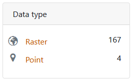

Faceting is the process of narrowing search results based on dataset characteristics. The GeoData Portal makes it possible to filter search results based on qualities like:
- the Provider through which access to data is shared
- a specific Place keyword
- the Format of the data
- the Resource Class type of the data
- the Year that the data/map was originally published
- the original Creator of the data/map
- the original Publisher of the data/map
- a particular Subject keyword
- the Theme of the data/map
If you find that applying a particular facet severely limits the results returned and want to remove the facet you’ve applied, click on the X symbol to the right of the active facet name at the top of your search results window to remove it.
Browsing

If you would like to browse through the datasets available in the GeoData Portal, there are a few different options available to you. To see a full list of all datasets that are discoverable in the GeoData Portal, click the
Browse All
button at the top of the Portal window. You can alternatively click the icons or subject keyword links on the GeoData Portal home page to browse data in featured UT Libraries collections or look through datasets which fall into prominent categories.
Interpreting Item Information (Metadata)
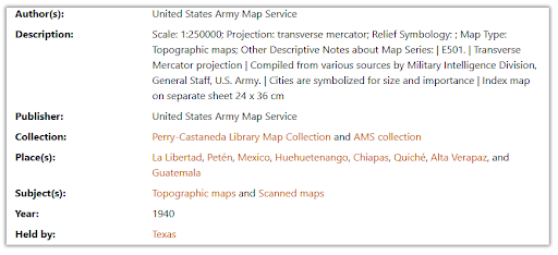
The information you see on an item’s description page (the page you access when you click on a dataset title listed on the search results page) is metadata that describes the information found in the dataset itself. The metadata text you see in this section is the same text that submitted search queries are run against.
Downloading Data

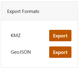
Datasets can be downloaded from the GeoData Portal in a variety of formats for use with GIS software. Raster datasets from the University of Texas’ collections can be downloaded as cloud optimized GeoTIFFs while UT vector datasets can be downloaded as zipped shapefiles.
Datasets from other universities that are made available through the GeoData Portal may be available in other formats or have more limited download options. All University of Texas datasets available for download are georeferenced and unprojected. Downloaded zipped files will need to be uncompressed before they can be loaded in GIS software.
Citing Data
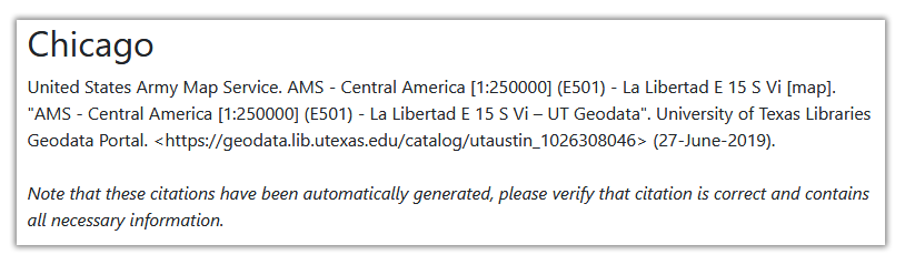
The GeoData Portal provides prestructured citation information for geospatial datasets that can be accessed from each dataset’s item description page. These citations are automatically generated using the metadata available for each dataset and may not be perfectly constructed due to variations in metadata content. Please check each provided citation carefully before using it in a paper, presentation, or publication to ensure that it meets the appropriate citation formatting standard for your document. Keep in mind that some information may need to be manually added, modified, or removed.
FAQs
Are there any copyright restrictions that affect the use of geospatial data from the UT Libraries’ collections?
All georeferenced scanned map images available for unrestricted download from the UT Libraries’ collections are
in the public domain because they are government-created or because their copyright term has expired. The vector
datasets found in the GeoData portal that are shared from UT collections are either public domain or permission
has been obtained from rights holders for the data to be shared through the portal.
What is GIS software and how can I get it installed on my computer so that I can work with data that I’ve downloaded from the GeoData portal?
Geographic information system (GIS) software is specifically designed to facilitate managing, creating, editing, analyzing, mapping, and sharing geospatial data. There are several popular GIS software applications that can be used for working with data downloaded from this site. For help determining which GIS application best fits your needs and guidance on installing GIS software on your computer, please refer to the UT Libraries’ detailed instruction guide at
https://guides.lib.utexas.edu/gis/install-gis-software.
I’m a UT researcher and want to share my data with others. How can I make my data discoverable through the Texas GeoData portal?
There is not currently a system in place that allows UT researchers to independently make their geospatial research data discoverable
through the GeoData portal. If you are interested in sharing your data and making it discoverable by others, the best option
for doing so is the Texas Data Repository (TDR) which does allow researchers to upload their
own datasets for long term preservation and dissemination. If you have further questions about sharing data through the portal please
contact the UT Libraries’ GIS and Geospatial Data Coordinator at gis@lib.utexas.edu.
I am able to find a printed map listed in the UT Libraries’ catalog but I cannot find a digital version using
the GeoData portal. Is there any way to access a digital version of this map or view the paper copy of the map?
The Perry-Castañeda Library (PCL) Map Collection contains over 250,000 physical maps which you can check out by visiting the map room on the first floor of PCL. Currently only a limited number of maps in this collection are accessible through the GeoData Portal due to the fact that many are 1. under copyright and cannot be scanned or 2. are in the public domain and have been scanned, but still need to be georeferenced. Of those in the public domain, approximately 70,000 maps have been digitized and scanned images of these maps are available on the
Perry-Castañeda Library (PCL) Map Collection website.
Tens of thousands of these maps are also available discoverable in our
Collections Portal
which provides search functionality and allows for high resolution map image downloads.
Are the geospatial datasets available for download through the GeoData portal georeferenced and projected?
All University of Texas datasets made available through the GeoData portal use the WGS 84 (EPSG: 4326) coordinate system
by default and are unprojected. They are georeferenced to their correct location on Earth according to this coordinate
system so that they can be used in GIS software without any preprocessing. In order to ensure compatibility with other
datasets you are working with that may come from other sources, and to minimize spatial distortion on any maps that you
produce with data downloaded from the GeoData portal, it is recommended that you set the coordinate reference system (CRS)
of your GIS project to the CRS most appropriate for your study area prior to loading data into the project. Be aware that
data obtained from other universities through the GeoData portal may not necessarily be georeferenced and use the WGS 84
(EPSG: 4326) coordinate system.
What metadata schema is used to structure information about the datasets in the GeoData portal?
The GeoData Portal web interface is designed to query reference metadata that has been organized in an Apache Solr index and formatted according to the Aardvark metadata schema. Metadata in the ISO 19139 metadata schema (the international standard for geospatial metadata) can be downloaded from the item record pages of most datasets found in the GeoData Portal by clicking on the Metadata button listed under Tools in the upper right portion of the page.
Is it possible to download a collection of datasets in bulk?
Bulk downloads of geospatial data are not available at this time.